|
|
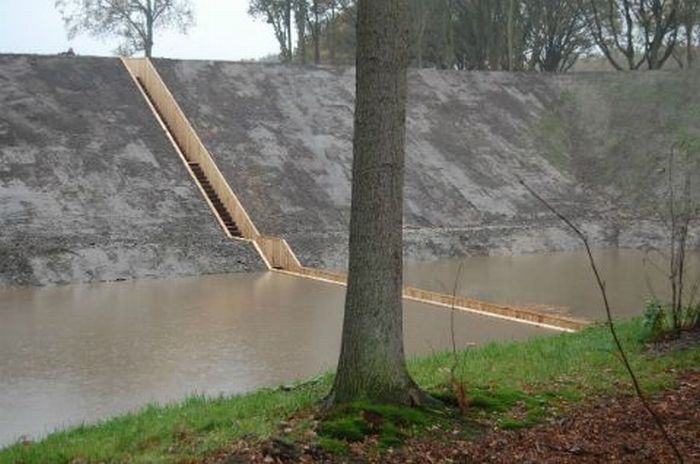
Fort De Roovere Bridge, West Brabant Water Line, Netherlands
|
During the 17th century, a series of moats and fortresses were built over the West Brabant Water Line region of the Netherlands to provide protection from invasion by France and Spain. Fort de Roovere was surrounded by a shallow, muddy moat that was too deep to march across and too shallow for boats. Recently the fort was opened for tourist but instead of building an overbridged over the moat which would have definitely taken away the fort’s dramatic view, a sunken bridge was designed.
The bridge might be slightly bigger or slightly smaller. It might be spanning a river, a bay or a canyon. It might be made of wood, stone, metal, plastic or any other material. It might be new or ancient. But it will look like a pathway that goes over (i.e. elevated) some area. The reason most people will imagine a bridge in this form is because that’s what we are used to seeing. However, thinking beyond the established is one of the hallmarks of a creative person.
|
|